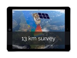
13 km survey from space
A complete 13 km survey solution
Imagine a 13 km survey that includes satellite monitoring, automated reports and a specialist assessment that can be used as a part of your wildlife risk management program. With the Ascend 13 km satellite monitoring service, we will provide your airport with:
· A complete 13 km survey
· Landscape change identification
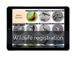
· Off-airfield wildlife registration

Drag slider to identify changes

Process description
- Satellite monitoring: Your Airport is mapped by satellites on a monthly basis
- Identifying changes: Online satellite maps are made available to you
- The 13 km satellite report: Available to you as a pdf report
- Register sites: Combine the identified changes with local knowledge
- Plan your actions: Continue monitoring, on-site inspections or talk to land owners
- Site monitoring cycle: Monthly satellite monitoring of specific sites
- On-site visits: Wildlife is observed and quantified
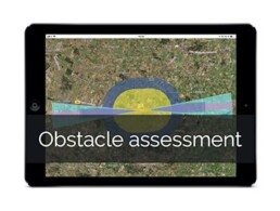
- Mitigation and risk: Assess the problem. Can it be mitigated? If yes how?
Track water movements
Water attracts wildlife, therefore it is important to monitor. Based on multispectral data from the sentinel satellite constellation we can map water bodies. Using this solution we can identify changes that could impact wildlife behaviour. The “water map” is available in the Ascend web-portal, but take a second and try it out below.
Drag slider to identify changes
Detailed process description
1. Satellite monitoring
Your airport will frequently be mapped by the Sentinel-2 Earth observation satellite constellation, developed to perform terrestrial observations such as landscape changes. The satellite data will be made available to you.
2. Identifying changes
The digital satellite maps let you, or our wildlife specialist, identify changes to the safeguarding zone, that impact wildlife behaviour. The 13 km monitoring module provides analysis and site registration capabilities, that allow you to act and mitigate the risk. With the Ascend solution, you get a complete overview of the 530 km2 safeguarding zone.
3. The satellite report
You will be receiving pdf reports comparing current and past satellite images. Maps are divided into grids, making it easy to locate relevant changes. You can view it both as a digital map, or by opening the “13 km report”. The reports should be signed and dated by you on the last page, and then saved as documentation.
4. Register sites
Combine the identified changes with your local knowledge and your specialist advice. Based on this, choose the sites that should be monitored in the Ascend web-portal. If you are already monitoring sites, we can include these in the process.
5. Plan your actions
Use the satellite maps to identify changes, that could potentially impact wildlife behaviour. Afterwards, you have several options:
- You can continue monitoring the site to assess if the change is permanent;
- You can perform on-site visits to assess wildlife activity;
- You can move directly to stakeholder communication;
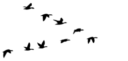
Before doing on-site visits, wildlife activity levels could be defined as low, medium and high. Each level triggers a different response. The activity level (number of birds) and risk level (based on your on-airfield risk assessment or the weight of the birds) are quantified in the “Off-airfield recording reports”.
6. Site monitoring
The sites are assessed regularly in updated satellite images. An additional feature available in the service is a specially designed “find water” analysis. Furthermore, other map layers make it possible to thoroughly inspect each individual site.
- If significant and relevant changes are identified, the site can be upgraded to “on-site visits”.
- If no relevant changes occur on a site in the site monitoring list for 12 months, it can be removed from the list.

7. On-site visits
During an on-site visit, wildlife is observed and quantified. This is done using the Ascend Off-airfield wildlife recording flow where position, time, species, number of individuals and their activity (resting, flying, feeding) is recorded. All data is available in Off-airfield wildlife recording reports and as a download file. Activity levels are defined as high, medium and low.
- If low wildlife activity is recorded over a period of time, the site is downgraded to “site monitoring” or removed completely.
- If medium wildlife activity is recorded over a period of time, the on-site visits continue, unless the activity can be described as not posing a threat to flight safety.
- If high wildlife activity is recorded, the site is upgraded to “mitigation”.
8. Mitigation and risk
Assess the problem. Can it be mitigated? If yes, how? We have an example; contact the land owner to get permission to deter Canadian geese from night resting at a lake. If the site is not part of the existing 13 km risk assessment, it is then assessed once an update is relevant, allowing you to perform continuous satellite monitoring, and carry out on-site visits.
Other Ascend services and products